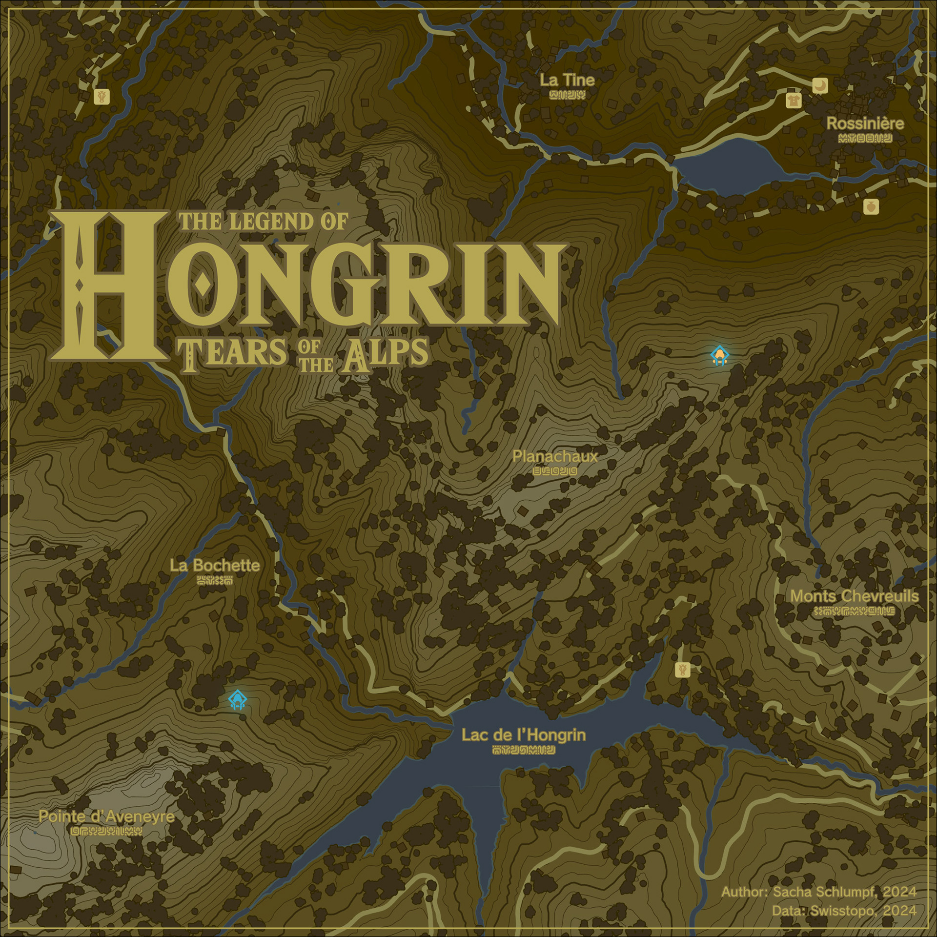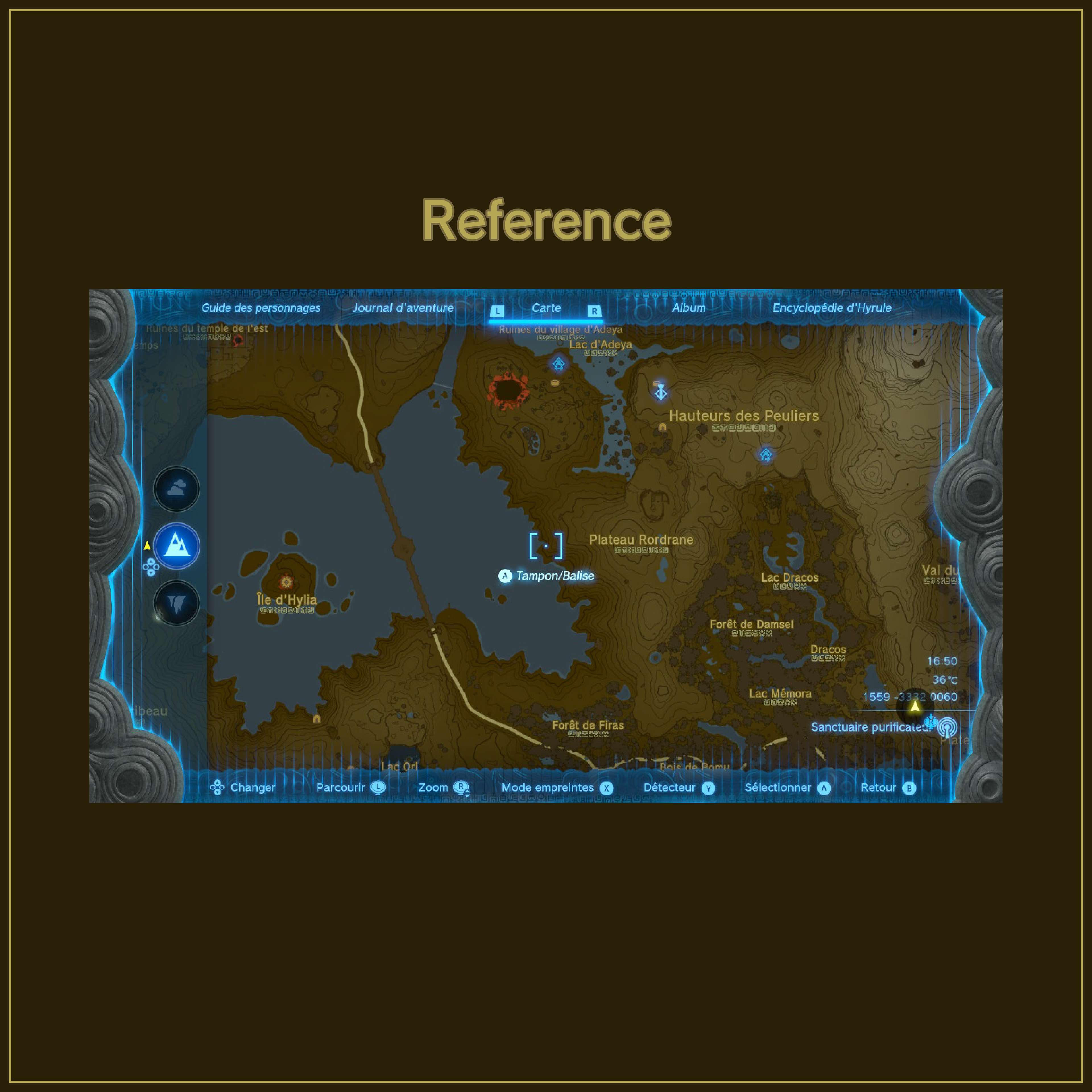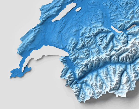
A real-life Zelda map?
In the latest Zelda games, the map plays an absolutely central role, as the game is based on exploration. I've always found this map to be very well designed, and for fun I set myself the challenge of reproducing this style for a real-world region.
And here it is! A map of the Hongrin region of Switzerland, around this magnificent mountain lake. Fortunately, there are (presumably) no goblins or other monsters around this lake.
To reproduce this style, I've analysed in detail how the different layers are visualised. Using the eyedropper, I was able to reuse the same colours. For example, it's interesting to see that the roads, which look yellow, are in fact a rather unattractive brown-green. But in context, it works!
It was also interesting to reproduce this forest effect from a layer of dots. To do this, I created 5 different tree shapes, randomly assigned to each point, which are then randomly rotated and sized. A second layer, underneath, with the same parameters, is used to create the dark outline!
Tools: GIS | Illustrator
Format: Social media
Context: Personal project