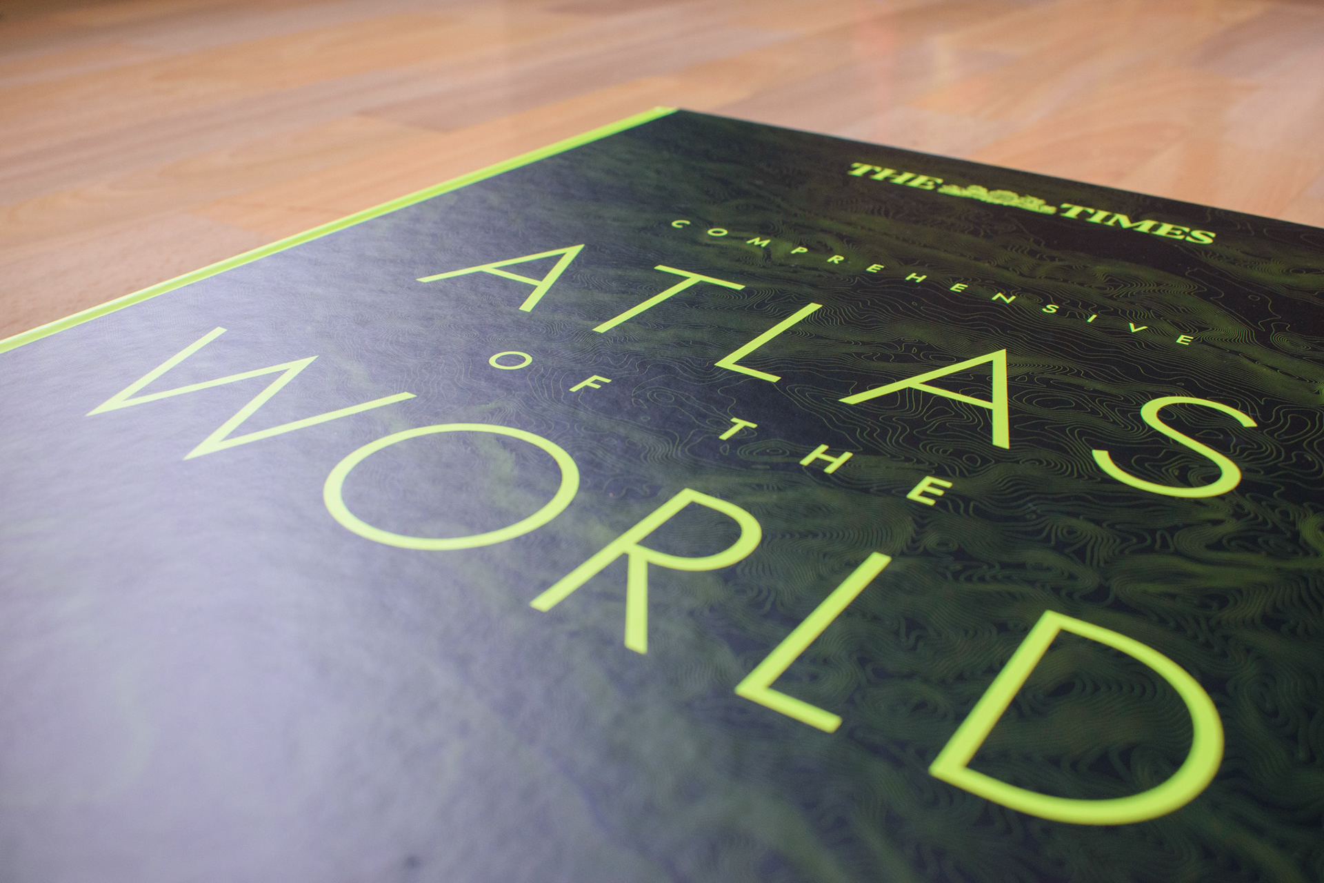
The Times Atlas of the World is a highly detailed and authoritative atlas that provides comprehensive mapping of the Earth, including political boundaries, physical features, climate, and more. The book is regularly updated to reflect changes in the global landscape.
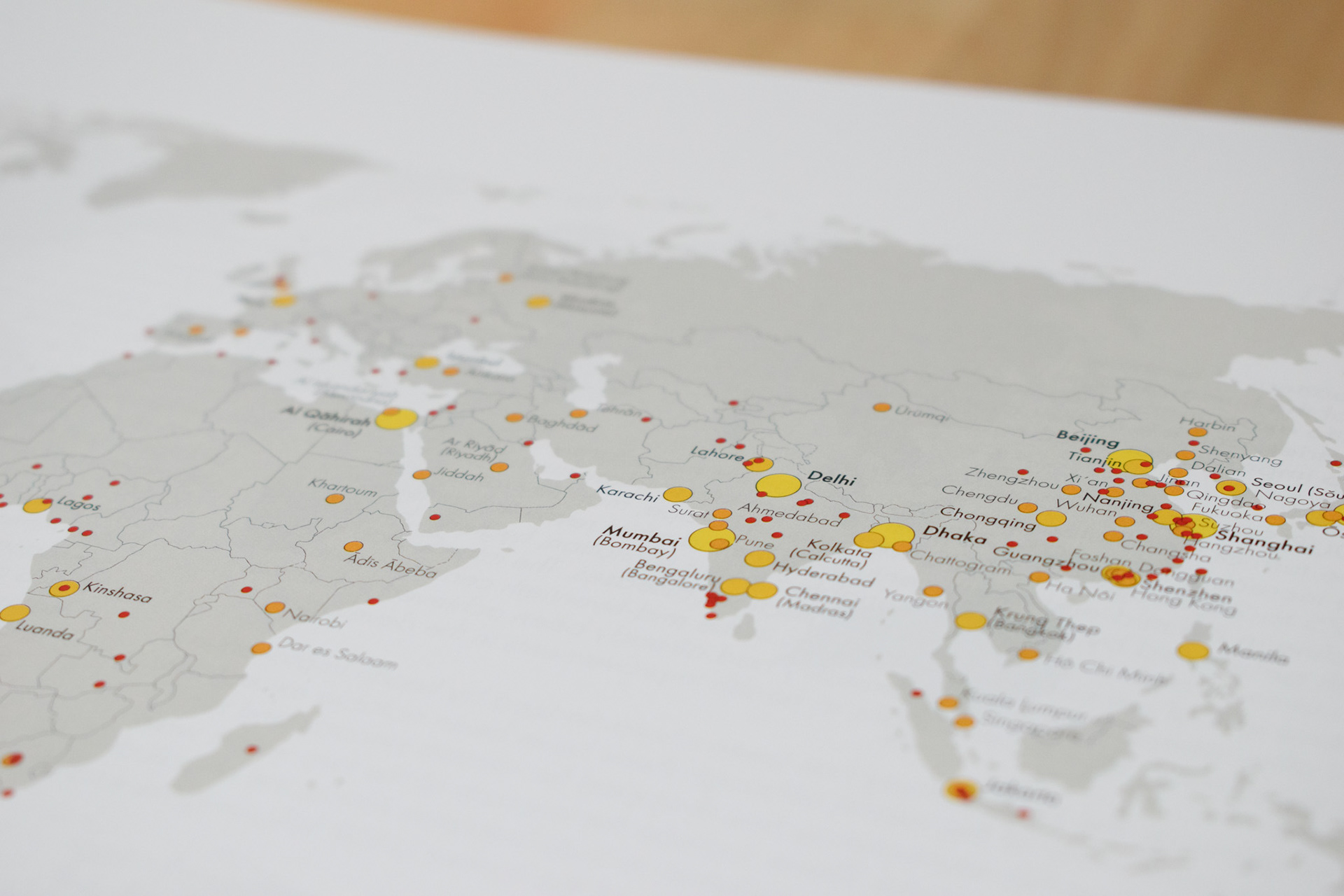
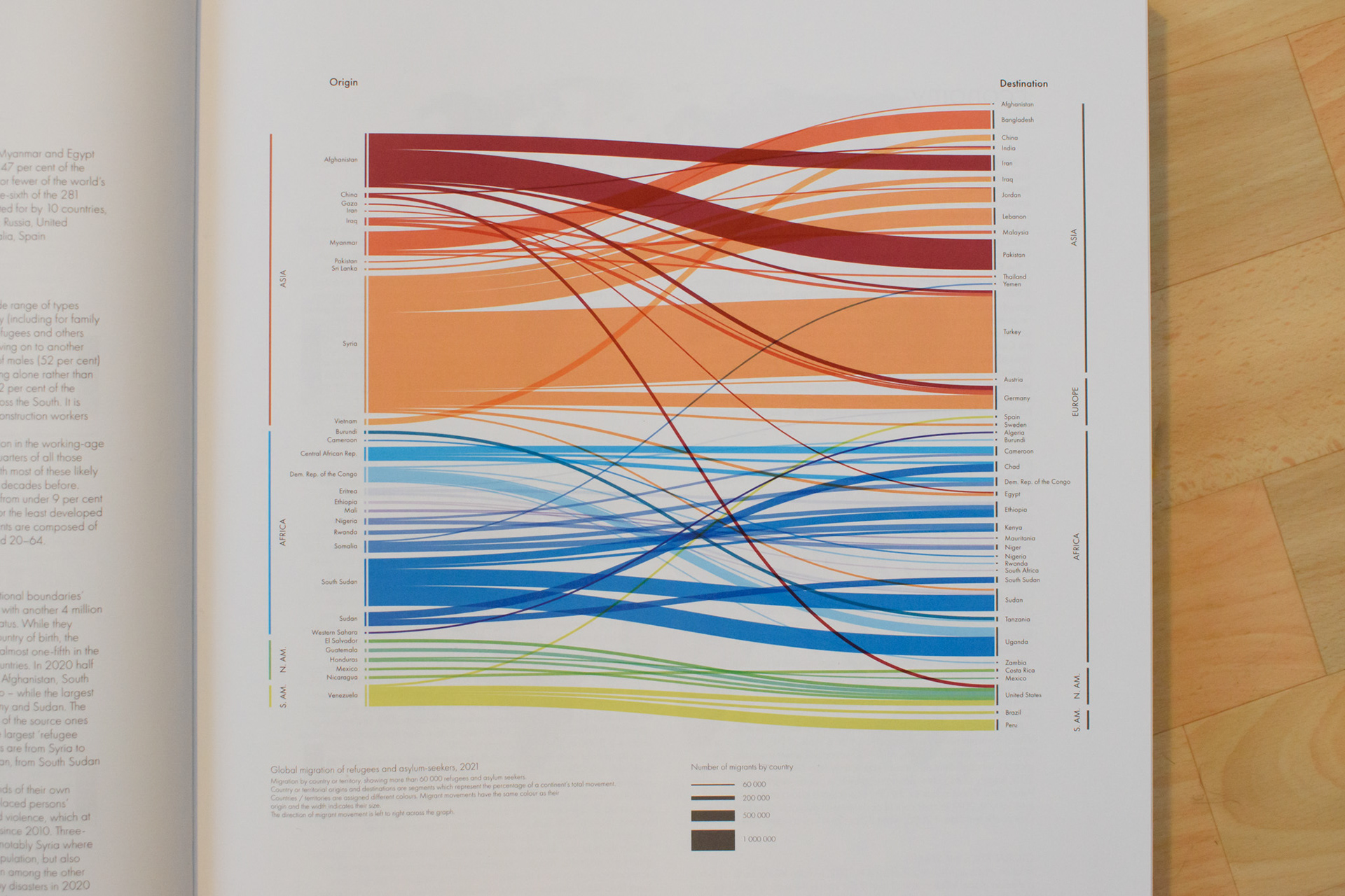
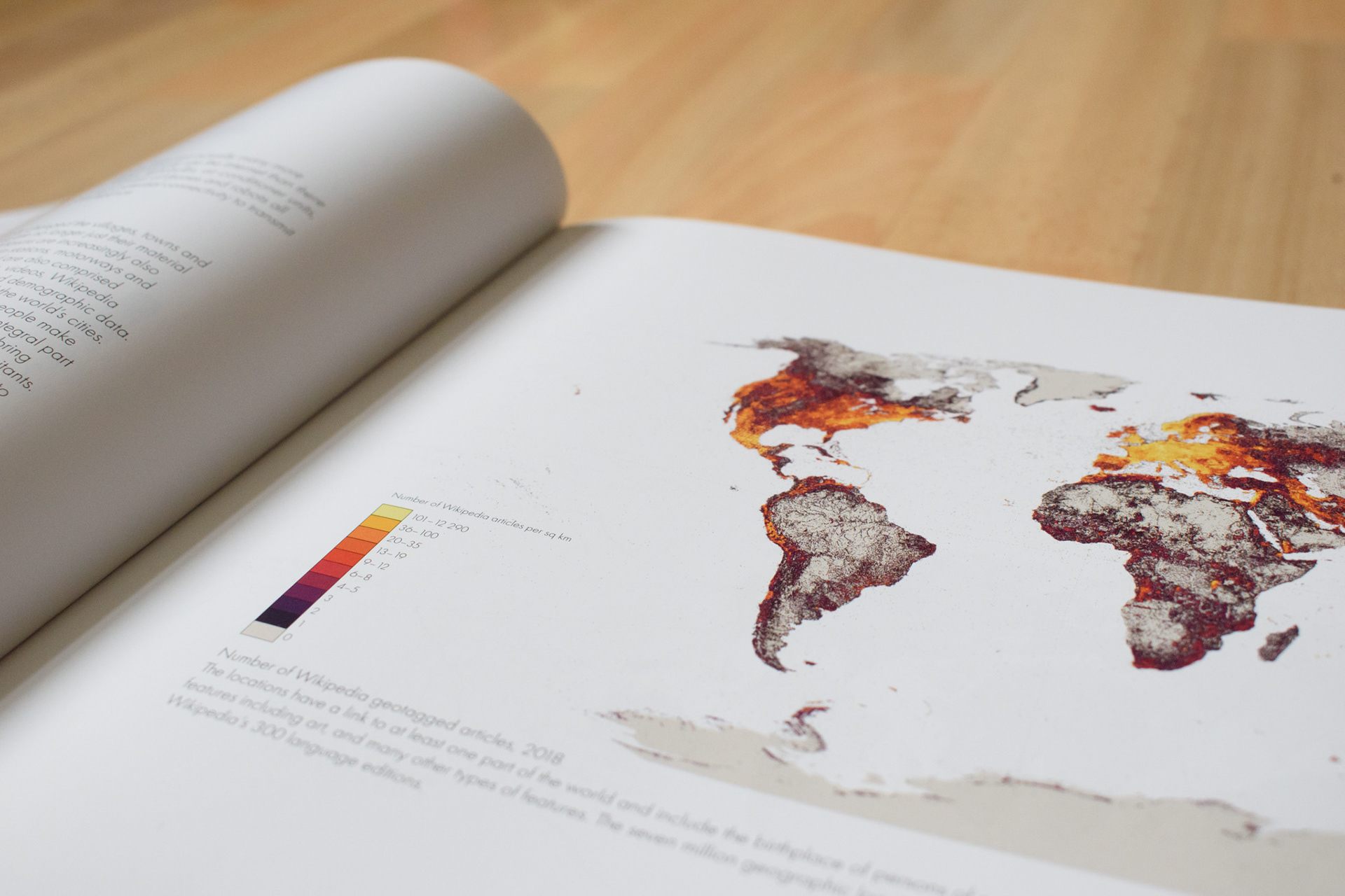
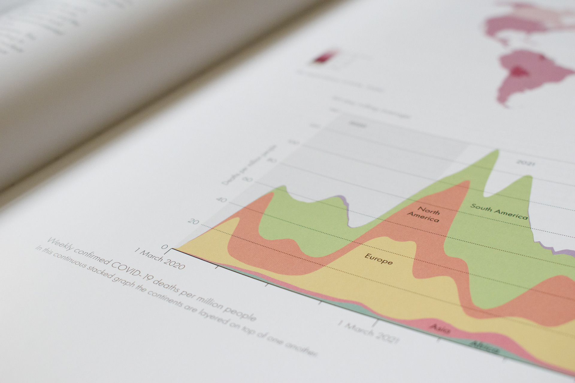
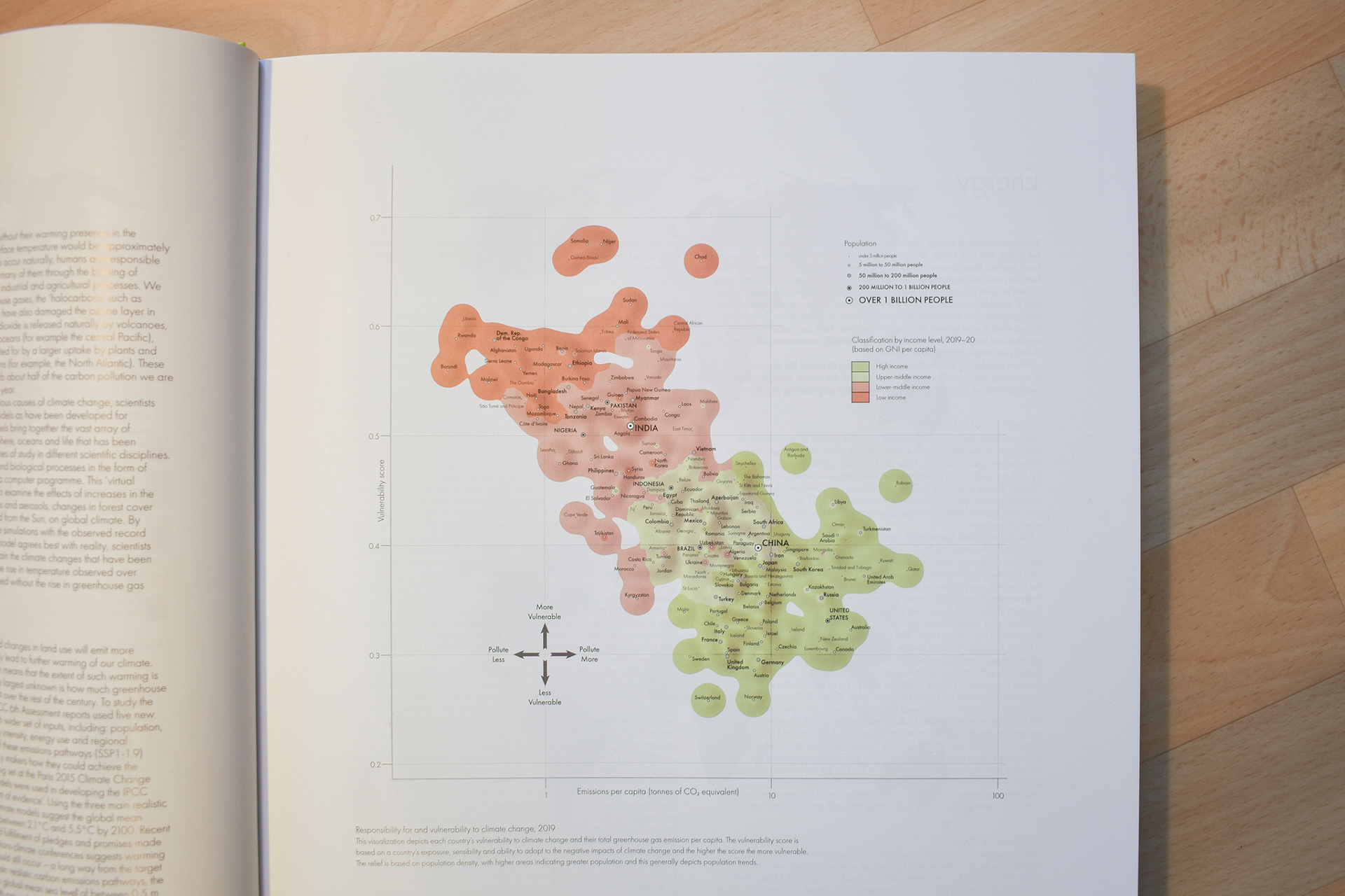
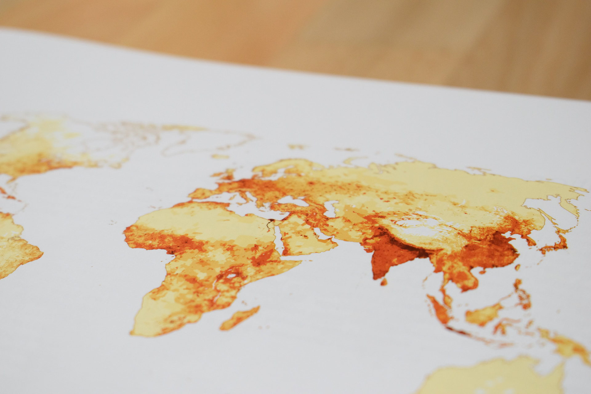
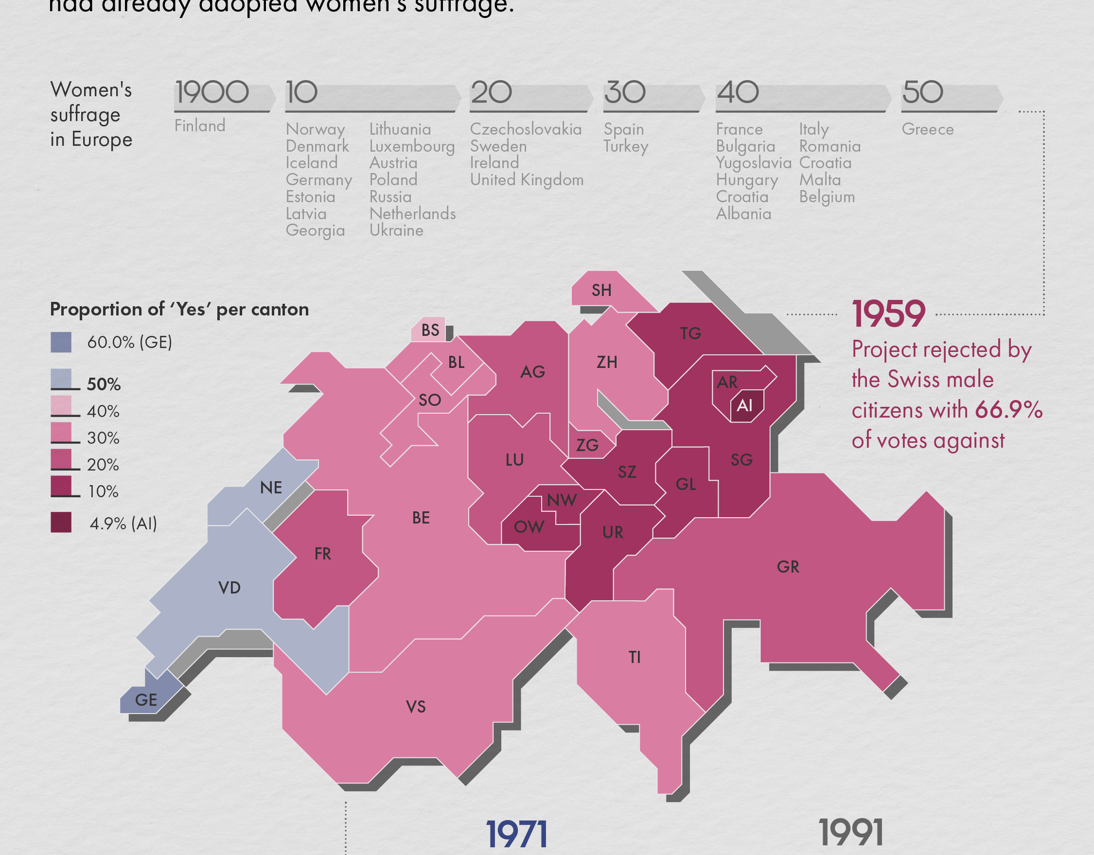
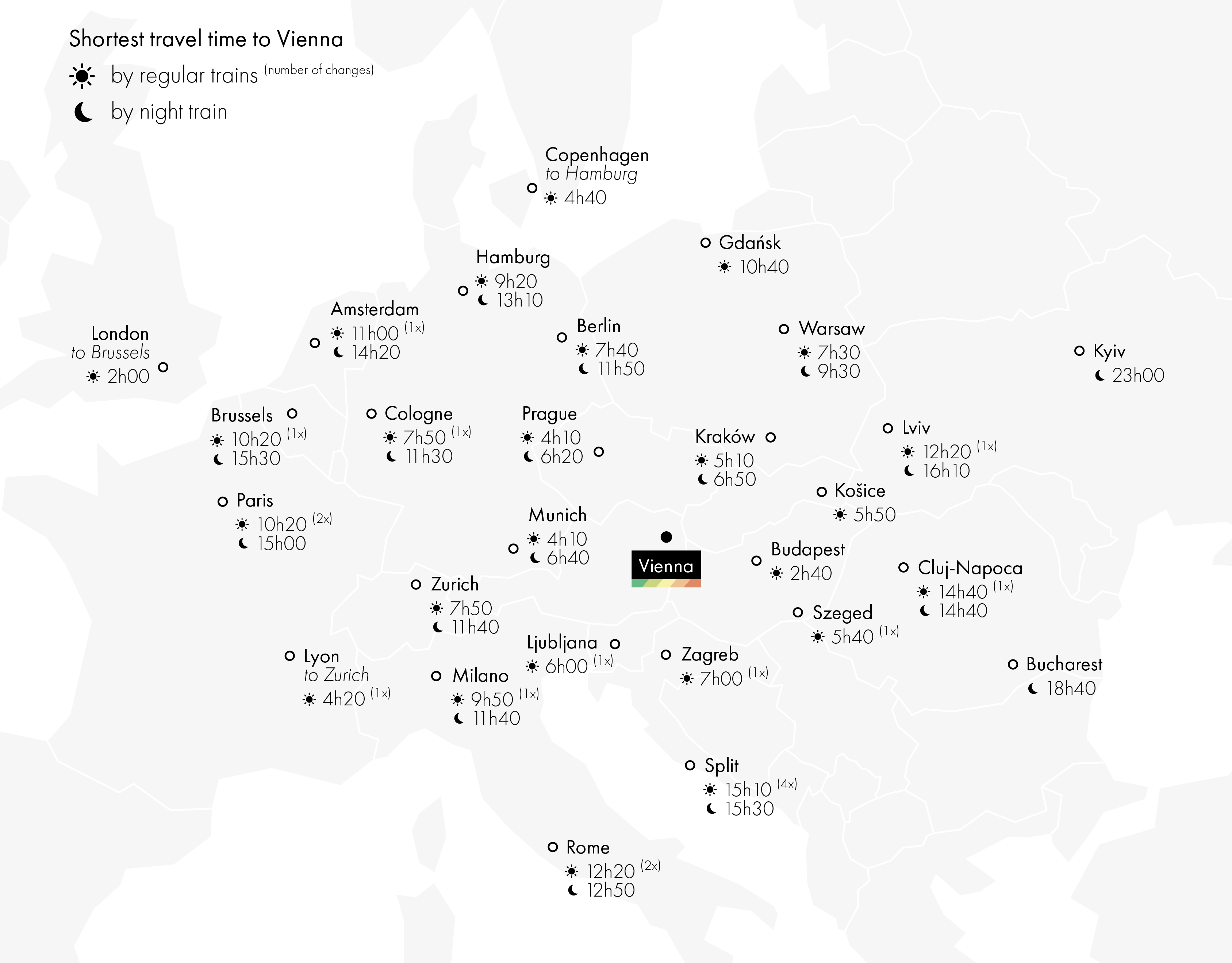
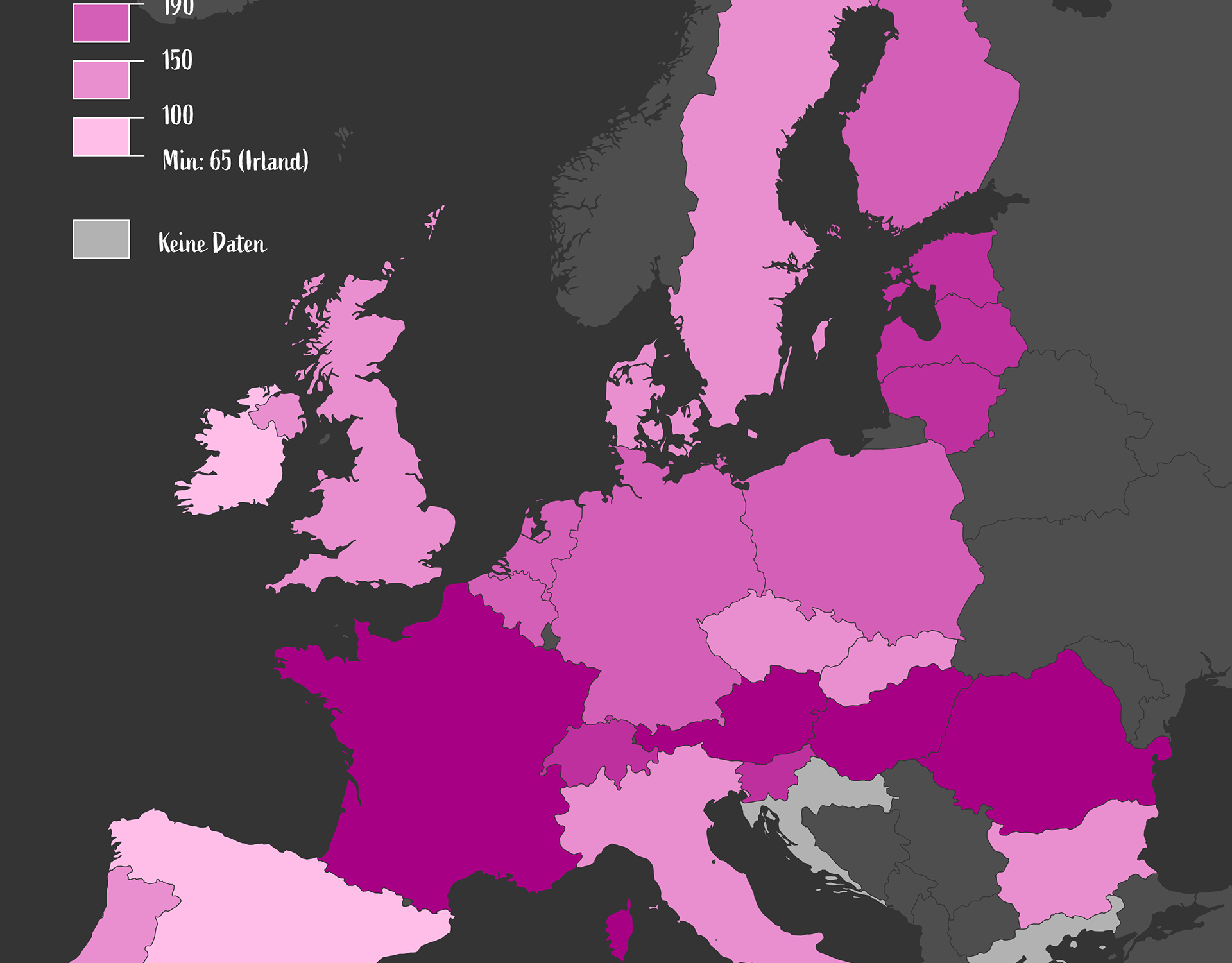
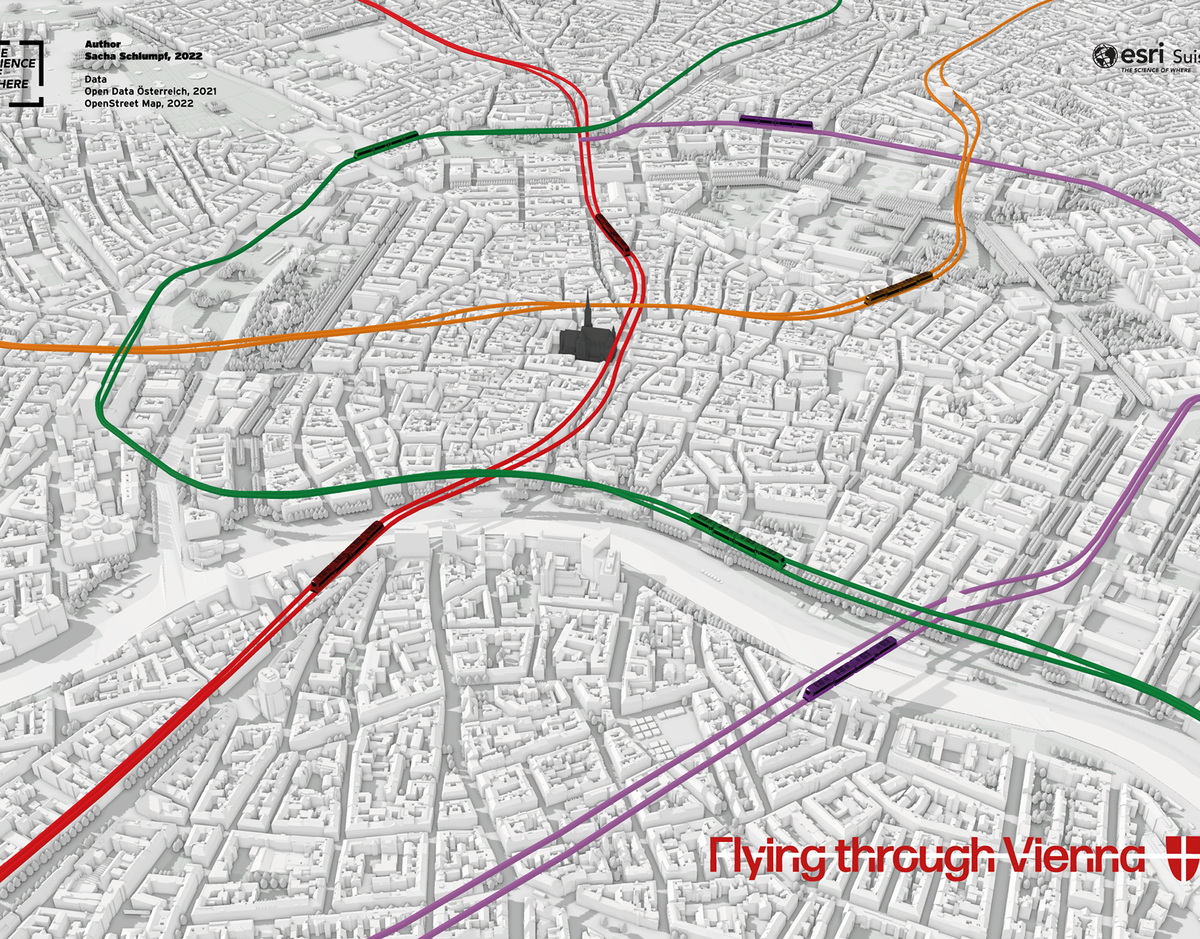
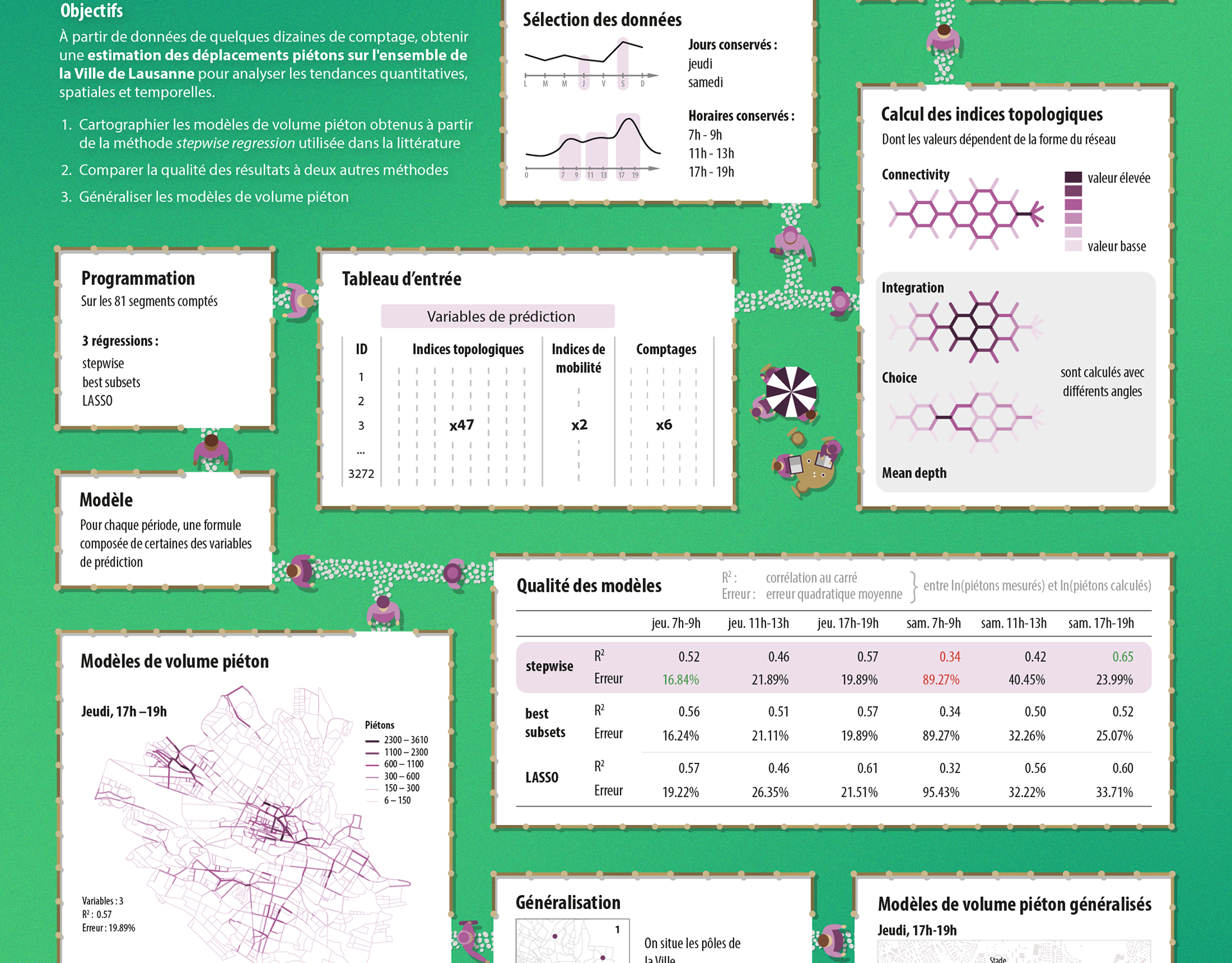
In 2023, I was involved in the creation of the thematic maps and infographics that appear at the beginning of the atlas. It was a great experience that allowed me to learn about the meticulous process behind the creation of this atlas, while still giving me the opportunity to express my creativity and experiment with new ideas.
These maps and infographics – alongside many others – were created at HarperCollins Publishers in Glasgow, Scotland. My role varied between the different maps and included tasks such as data selection, geoprocessing, design and layout, and discussion of new ideas.
All of these maps and infographics are published in the 16th edition of the Times Comprehensive Atlas of the World, available for purchase here.
Tools: GIS | Illustrator
Format: Book
Context: Contract with HarperCollins Publishers